The Motivation for this Journal

My name is Matt and I play in West Virginia. Actually, I'm addicted to the state.

Living inside or within a few hours of a WV state border for all of my life, I've had plenty of "West Virginia Moments," a characterization that could range from WV stereotype reinforcements of the cultural (could be bad) to the natural persuasion. Fortunately, the number of the latter is far greater than the number of former.

I wish to document with this blog these "West Virginia Moments." If you're reading this, then you are a friend or family member, or have stumbled upon this blog, and I thank you for reading and hope you'll get a laugh, discover a new natural place in WV, or gasp at the thought of it. However, the real reason for this blog is personal. I will consider this blog an archive of these moments for a man with a poor memory.

Enjoy!

17 December, 2007

Adventures North of the Border


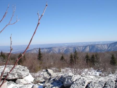
This weekend I spent the days on PA rivers. My trip report from Got Boof from a dramatic Sunday on Indian Creek is reprinted here:

The elation associated with seeing my friend Mike ashore, grinning and arms waving, was significant enough to allow me – for a moment – to forget about my physical discomforts. The soreness in my back from paddling as swiftly as possible for five miles and the numbness in my fingers, the stinging on my face, and the shivering in my core from doing so in sub-freezing temperatures into a strong headwind were overtaken by relief. Mike was literally and figuratively out of the woods and this meant that we would not be faced with the prospect of beginning a search for him there in these conditions.

We started the day with a plethora of prospects, but needed to be on the safe side. It had rained enough overnight to bring up some of the gauges and because Mike is a beginning paddler, the options were a bit more limited. After toying around with the idea of the Casselman River (too high), Laurel Hill Creek (probably our safest bet), and Indian Creek (just a bit of a challenge for Mike), we opted for the latter because it came with the addition of our friend Jason, who would add 33.3% more safety on the water. That seemed to make Laurel Hill Creek a less desirable option, and as we found out later, that was actually a 50% increase because our friend Art came along as well. Indian Creek it was. Grease Fire did his best Indian impression, though I'm not certain that any American Indian actually ever repeatedly hit his or her mouth with their hand while making a loud "O" sound.

Indian Creek at the level we found it yesterday is a lot like the Lower Yough with the addition of two 6-foot ledge drops that excited the experienced paddlers in the group (Art, Jason, "Grease Fire" Rob, and me) and challenged Mike to experiment with a boof stroke. His first experiment failed, and after a short sideways ride in a curtain, Mike swam out of his boat. Strike one. In general, few holes on Indian Creek were not punch-worthy, but Mike found one of these a short time after his first swim. Strike two. In fact, after swimming out of this hole, his boat found itself abandoned for the first time that day on a mid-river ledge. No fear; Indiana Jones brought his whip. Cue in the theme music.

With Mike's third swim came his third strike. All agreed it was time to walk. Because we were more than halfway down the Indian, he would walk downstream. When he reached the confluence with the Yough, we would all paddle the flatwater five miles to the take out. The wrench in the plan came about 30 minutes later when Jason and I realized that there are two un-crossable tributaries before that, Rasler and Richter Run. It was at that moment that I became unnerved with the situation, and so when we got to Rasler Run, I insisted on hiking up to find Mike. Also at that moment, Mother Nature chimed in with her interesting twist: a snowstorm.

And so I spent the next 90 minutes (wild guess here; no watches in the group) hiking up and down Rasler on both sides trying to locate Mike. Blowing my whistle and shouting was unsuccessful as I crawled on all fours against the cold ground through thick rhododendron. Grease Fire waited at the confluence and eventually huddled under a thick patch of rhododendron to stay warm. Art and Jason hiked up Rasler with their boats for about ¾ of a mile and paddled the class 5 creek back down. When we reunited at the small creek's end, we decided that the situation was now urgent enough to make our main priority getting to Mike. And, he had to be somewhere between Rasler and the put in, an area we were now unable to adequately search because we were downstream of it.

The beauty of shoving our kayaks back into Indian Creek with big, heavy flakes dropping was barely noticed as we all pushed on. As we approached AW-rated class 5 Terminator rapid, I bowed to the River Gods and asked for kindness. We scouted, and all ran the big Upper Gauley-esque wavetrain with no issues. In a rapid below that, Rob was surfed sideways into a big hole. As we all reacted by turning around to help, Jason was closest to him. Rob wrestled with the hydraulic for a 20-second ride, was flipped, and then surfed himself out the side of the ugly hole. Upon reaching Jason, he sternly said, "We don't have time for a swimmer." Cue up that theme music one more time.
The day was clearly getting late when we reach the mighty Yough. Looking more like the Ohio, the river was more than 100 yards wide and the wind was whipping whitecaps into showers of spray. A plan was initiated, though I think that it was probably slightly different in each of our heads. In mine, it was as follows. I would paddle hard with keys to one of the take out vehicles, warm it up and get changed into dry clothes. That would allow me to load boats onto the roofs while the others changed and warmed up. Once we were ready to move, one car would go straight to the put in vehicle, hoping to find Mike there. The other car, equipped with a Gazetteer, would take a detour and explore the back roads on the upstream side of Rasler Run, hoping to find Mike there. We'd meet at the put-in car, where there was food, and if we didn't have Mike with us by then, one car would stay there and wait while the other drove to the Fire Department in Ohiopyle (about 5 miles away) to get help. It was very cold out and the snow was piling up. Mike would not make it through the night if he was in the woods in all of his wet paddling gear. I was concerned to the point that I'd accepted the necessity of spending whatever money was necessary to get the four of us geared up to hike into the woods for many hours in these conditions at night. I was putting together a mental list of gear for each of the four of us: headlamp, extra batteries, sturdy boots, outerwear, thermos with hot tea, food, blankets, etc.

It was only a week ago that a few acquaintances had been lost in the woods of the Otter Creek Wilderness in West Virginia after an unsuccessful attempted first "complete" descent of Moore Run. There were only two of them and one spent the night in the woods after suffering a broken nose and serious lacerations on his face, both of which occurred during a bad swim after the two men had separated from each other on the river. It all turned out well, but the night was in the low 40's and it was dry. With the weather into which I was now paddling, the situation that I was now envisioning was potentially deadly for Mike.

Mike's solo landborne experience was not psychologically dissimilar from ours, and he made all the right decisions. Upon reaching Rasler Run, he discounted getting in his boat or attempting to wade across. Rather, he remembered us showing him a secondary road that goes to its put in. So, he quickly and smartly diverted his downstream journey along Indian Creek into an upstream journey along Rasler Run. Ducking the thick rhododendron underbrush on all fours in the snow, Mike dragged his heavy kayak behind him for what mush have seemed like an eternity. We could have been separated by only a few hundred yards at that time and wouldn't have known it. The heavy load undoubtedly kept Mike working hard enough that he was warm, but that also meant that he was expending a lot of energy he would need if he was stuck overnight. But, he didn't need it, because there was NO WAY he was getting stuck overnight; it would be fatal. Mike soldiered on to a backroad, and in his own words, knew that he would be fine. He picked up his boat and followed the road uphill out of the creek's drainage region. Miles later, exhausted, he got to the main road, Rt. 381, dropped his boat in a ditch, and earned his new nickname: Hitch. His approximation of the time spent hitch hiking is 90 minutes. It was now in the 20's, approaching darkness, and the snow was creating near whiteout conditions. Mike must have been equally as afraid of a car sliding into him as he was of one never stopping for him. When he was finally picked up, he had no idea where to go. As a new paddler who lives 4 hours from this area, he is not familiar with the region. After he and the driver quizzed each other on nearby towns and waterways, the conclusion was drawn that he would find us at out take out near the Rod & Gun Club in Connellsville. The man drove him out of his way for more than ten miles through the big storm. Insert divine intervention reference here.

And so another epic day on the river came to a shivering end, with the five of us screaming and hugging, celebrating there on the side of the Yough just upstream of Connellsvile. Ice coated all of our skirts, helmets, and life jackets. Mike was now cold enough to be going into high frequency vibration. Cars were started, warmth returned, and the long, slippery drive home began. Ironically, the question "Got Boof?", had it been posed to Mike before launching into Indian Creek and pondered seriously, would have radically changed the course of the day.

10 December, 2007

XXX in MMVII

On Sunday, December 9th I paddled to the confluence of class 4 Teter's Creek and the flooding Tygart River in Barbour County. I waited for the crew with whom I had been boating to assemble, slogged through marshy grass while carrying my kayak from the creek bed past the piers of an abandoned railroad bridge and up a steep embankment strewn with bottles, television sets, and appliances, and dropped the heavy boat at my car. It was cold and soggy and the puddles around my car were deep and muddy, but I had just paddled two amazing and intense creeks, the second of which was a milestone. Despite the muggy day, I was even happier than I typically am in this scenario because I had completed a goal that I had set when I realized that I was pacing rapidly through new runs at some time around the Webster Spring Wildwater Festival in March. My goal of paddling 30 new runs in 2007 had been realized.

Like every other exploratory goal, my little, adventurous goal provokes controversy.

First, paddling Little Sandy Creek into Upper Big Sandy Creek counts for two according to AW. But, I'll need to get in one more new run before the end of the month to simply satisfy my own self-skepticism. Two runs, Rasler Run and the Rapidan River, are seldom run and so they are not official AW reaches. Rasler definitely makes the list (see www.got-boof.com for trip reports from both Rasler and Laurel/Teter's) but the Rapidan was a very small flooded stream with little gradient. So, if I want to be a snob about it, I need to replace the Middle Yough and the Rapidan with some more bona fide whitewater. The goal will hopefully be solidified in the next few weeks with two more good runs.

And, it just rained a lot.

Here they are, organized by state.

2007-1 MD Savage Merrill - Lake (Upper)
2007-2 MD Savage Lower
2007-3 MD Yough Upper
2007-4 MD Yough Top
2007-5 NY Hudson Gorge
2007-6 PA Casselman Markleton - Fort Hill
2007-7 PA Laurel Hill Creek Whipkey Dam - Footbridge
2007-8 PA Rasler Run To Indian Creek
2007-9 PA Shade Creek To Stonycreek River
2007-10 PA Slippery Rock Creek Eckert - Harris (Lower gorge)
2007-11 PA Stonycreek Canyon
2007-12 PA Stonycreek Upper Gorge
2007-13 PA Stonycreek Lower
2007-14 PA Yough Middle
2007-15 PA Meadow Run Dinnerbell Rd - Ohiopyle
2007-16 VA Rapidan Rt. 231 - Rt. 29
2007-17 WV Big Sandy Little Sandy - Rockville (Upper)
2007-18 WV Potomac, South Branch Smokehole section
2007-19 WV Gauley Upper
2007-20 WV Gauley Middle
2007-21 WV Gauley Lower
2007-22 WV Big Sandy Lower
2007-23 WV Cheat Canyon
2007-24 WV Elk, Back Fork from Sugar Creek
2007-25 WV Little Sandy Rt. 26 - Big Sandy
2007-26 WV Meadow Upper
2007-27 WV Stony Dam - Rt. 50
2007-28 WV Potomac, North Branch Bloomingon
2007-29 WV Laurel Creek into Tygart
2007-30 WV Teter's Creek into Tygart

Note: Since writing the non-italicized text of this post, I have paddled two new rivers, Fike Run (PA) and Indian Creek (PA). So, I figure I've got that going for me, and I definitely hit the big three-oh.

Having a prolific year like this under my belt, I begin to feel like I'm actually worth my salt as a whitewater boater and that Life in West Virginia is good. This may or may not be the case, but if most definitely feels that way when I'm on my way to the river and the skies are dousing the watersheds.

Git 'r Dun.

04 December, 2007

Winter's Arrival

There are few things as pleasant as paddling whitewater in a snow storm. Uniquely pleasant, that is, in its simultaneous purity and complexity. At a glance from a calm eddy below the notorious Big Splat rapid, I stopped to witness the slow, downward drift of a million big, fat snowflakes, the thunderous waters of the Big Sandy chew away rock at a geologic pace, and a hundred mile wide cloud mass expose the sun to me through a tiny hole. I admit that I chuckled aloud in amazement.

And only two other people were there witnessing it all with me.

But I couldn't hear them.

Because the roar of whitewater is too loud.

And that damn rubber hat I have to wear was sealed over my ears.

I nearly missed this opportunity to experience the first day that Mother Nature showed us her cold side. With a big rain on Sunday night and steady snow throughout the day Monday, Tuesday shaped up to have a lot to offer. Thankfully, two paddlers from the DC area, Tyler and Matt, responded to message board posts. Neither had run this section of Big Sandy Creek before, and it is on every class 4 boater's list. If I had to rank the best types of experiences on whitewater, introducing a boater to a new river to run is just below being introduced to a new run. But, if the river is one of my own favorites, we can call it even.

According to the ultra-precise thermometer on my dashboard, it was 24 degrees when we parked the car at the put in. This was after more than an hour of driving to drop the shuttle vehicle at the take out thanks to the snowy, rough roads of Preston County, WV. I was told by Charlie Walbridge last week that the quickest way from Masontown to Bruceton Mills is through Jenkinsburg. This may sound perfectly normal to most, but Jenkinsburg is not a town and the road through it is more than 8 miles of rocky, muddy (and snowy today) switchbacks. We made it without a single slip.

Just as modern vehicles can be designed to tackle these roads, modern paddling apparel has been designed to keep out the cold. Never mind the fact that it takes a full 30 minutes to buckle, strap, and zip it on; it works. And so, Matt, Tyler and I put onto the river just under the bridge at Rockville (also not a town). And, I was responsible for getting them the appropriate information to successfully navigate the river. I am proud to say that I am apparently good at transferring this information, because when the information was given, all the right moves were executed. Strangely, both of them styled the line at Zoom Flume rapid, a line I have yet to style myself. All theory, no practice

One swim occurred and it was not in one of the major rapids. And, like I said, the gear works.

Reaching the take out point where the wild waters of the Big Sandy are injected into the wonderful Cheat River, a breath of relief accompanied each of our sighs of awe. This place is awesome.

Check out the photos.

Git r Dun.

14 November, 2007

Rockville to Jenkinsburg

It was Jeremy's idea.

On Monday, after he was characteristically late arriving to start an already rushed adventure, Molly and I joined him for a late night drive to drop a vehicle off in Jenkinsburg, where Big Sandy Creek meets the Cheat River. After that, we drove in a second vehicle to Rockville. It was past 11 pm when we finally got the the beginning of our trip, which would last only about 13 hours. And, it was was a seriously concentrated 13 hours.

To whitewater paddlers, Jenkinsburg is a familiar place because it is the take out point for these two classic runs and Rockville is a popular put in. And, though Rockville and Jenkinsburg may have the sound of established towns on some main road, perhaps with a few residents or businesses, they are not. As is the case with many places in Appalachia where the coal industry temporarily created a small community, the only evidence of civilization in both of these "towns" are old dirt and gravel covered mountain roads, a bridge, and a few misleading specs on the dated USGS map of the area. If you ask Google Maps for either town, you get rubbish for Jenkinsburg and a random point about five miles away for Rockville. Given the nature of our journey, this is poetry.

They were calling for rain. That's why we felt a bit rushed as we left the car to start the walk to Wonderfalls. We packed light for one night in the woods and only one substantial meal, so it didn't take us long to hit the trail. That is, it wouldn't have taken us long. However, Allegheny Wood Products, the owner of the forest (aka, timber) that is currently holding the ground together, has taken the first 3/4 of our trail and widened it into a road for its heavy machinery. We begrudgingly began to walk down this road in the trail's stead.

As if slogging down a 30 foot wide road of gravel-laced mud several inches thick wasn't miserable enough, the sight of large earth-moving, tree-digging vehicles brought our initial spirits to a minimum.

But, Jeremy got to drive the bulldozer (lemonade!).

With the road-making equipment behind us, our unseasonably warm night hike into Wonderfalls became much more enjoyable. We mindfully scoped out a place to pitch our tent that would hopefully be void of runoff from the predicted showers, eventually settling for a tree-covered spot about 50 feet above the falls and just off the riverbank. We were very glad to find that the tent held out all of the water because the showers most definitely materialized. A quick breakfast and coffee in the morning mountain fog got us rearing to move. So, we did.

Given that we were technically trespassing on our adventure, there were no trails. Navigation would instead be guided by a network of overgrown, long forgotten logging roads, the creek's deep canyon, and, ultimately, the far off sight of Cheat Canyon's steep walls that were blue with mountain haze.

We pushed through waist-high underbrush, wrestled our way through complicated ruins of downed trees, and scaled up and down loose, rocky sections of the canyon, all the while knowing that the car at the end of our journey was across the creek and there was no bridge. At some point, we'd be faced with finding a crossing. Secretly, I think that it was precisely this prospect that initially attracted both me and Jeremy to this trip.

After a few hours of travel, from a point high above the creek, we came to the decision that it was time to cross. As if we actually knew what we were doing, after descending into the canyon we arrived at the creek exactly where we'd hope we would. A bridge once crossed Big Sandy Creek here and three of the concrete supports are still there. This meant that had we crossed any further down the canyon, we'd have to ascend the steep walls to get to an old road bed and had we crossed further up the canyon, we'd have had to boulder-hop on the other side of the creek until we came to this point. It could not have been planned more effectively, with strong sarcasm underlying plan.

Crossing the creek was the trip's major obstacle. After over an hour of effort, our party of three adults and our three heavy packs had made it across, our lower extremities spending minimal time in the water. It was a game of Twister played in the roar of mild whitewater, shouting commands and encouragement to each other the entire time. The creek is about 25 feet wide where we crossed, and the boulders and shallow sections required about 5 or 6 moves and two or three of them were really tricky.

Allright. Put your right knee here on this rock and let your right foot dangle into the water until you find the rock to stand on. It's about 8 inches down. Okay, can you take your left arm and reach way out to grab that far rock? Nice! Now, reach across the deep part with your left leg and stand up on the rock that's just beneath the surface of the water. Watch it; that rock's slippery! Take your time! Nice work. Now, grab that first pack and toss it to me. Ready? Okay, on three; one, two, THREE! Good throw! Okay. I'm going to jump to that rock. Will you be able to grab me if I lose my balance?

I consider that creek crossing to be what made our trip down the Big Sandy epic. I've had one other truly epic hike in my life and it occurred in Shenandoah National Park, but that's not in West Virginia.

Once across the creek, it was about a mile and a half down the well-worn old road. Downed trees and evidence of landslides got in our way at a few times, but the elation of completing the journey was realized as soon as we were safely looking back nostalgically at our hairy crossing. Continuing, we knew we were near the car and in the vicinity of a swimming hole of overwhelming local popularity when we passed a very peculiar sign .

We got to the car reeking heavily of accomplishment. A man and woman sat on the tailgate of their pickup in Jenkinsburg drinking Natural Light. He asked us if we'd seen any wildlife. No, we told him, unfortunately it was an uneventful hike from Rockville. He asked us why in the world we walked that far through the woods, and I didn't tell him that it was because people like him don't. He told us to stick around and he'd show us some of the wildlife we failed to encounter. But, I had to get to work.

Enjoy the photos.

Git 'r dun.

04 November, 2007

Gauley

I sat at the foot of a 400 foot man-made wall of rock and gravel, over which vehicle after vehicle crossed carrying paddlers and their crafts to the legendary Gauley River. On a typical day, the dam holds back billions of gallons of water, but on this day, the dam was releasing 2800 cubic feet of it every second into the Gauley River, creating a playground and rendezvous of whitewater boaters for the Mid-Atlantic. I sealed myself into my plastic boat, took a big gulp to relieve the butterflies, and pushed off the boulder on which I had been sitting, splashing into the current. I was on my way.
In the Gauley River, West Virginia has one of the world’s most sought after adrenaline rushes. Whitewater rafting enthusiasts know it as the big one; the Everest of big water east of the Rockies. In 2000, my brother-in-law recruited some of my closest friends to accompany me in a raft down the Upper section of the Gauley during a dam release weekend. So, aside from my own memory deficiencies, I knew what I was getting into when I decided that I'd run it this September in my kayak.
On that raft trip, our arrival took place in the days when water came rushing horizontally out of two 20-foot diameter tubes that are about 30 feet above the river level. The Summersville Lake Dam engineers have since reconfigured the releases to bubble up from a place deep beneath the Gauley River at the base of the dam. It’s too bad, because seeing the violent rush of water just above the put-in for the Upper Gauley was poetic. Imagine the rush of an opened fire hydrant from the perspective of an insect.
Several people drown on the Gauley River every year during the 6-week season of dam releases, creating a sense of danger at the put-in. Some are rafters and many are kayakers, a stark difference between the Gauley and other commercially rafted sections of whitewater, where disproportionately few “hardboaters” pay the ultimate price. I found out for myself why the Gauley is very much an anomaly of whitewater this year by taking the thrill ride once again, this time under my own power as a hardboater. I made a last minute switch of guides from my good friend, Buck (sorry, Buck!), who was gallantly leading 6 new Gauley paddlers, to Chrissy and Chara (thanks, ladies!), who were not leading any new Gauley paddlers. Not to mention, Chara has navigated the Gauely for decades in every type of craft as high as flood stage. I knew I was in good hands.
The scene at the put-in is an interesting mix of anticipation, butterfly-provoking intimidation, solemn preparation, and celebration. The location is within driving distance of the Southeast, Northeast, and points in the Midwest. The release schedule is well-publicized. There are hundreds of options for camping. Add beautiful, unseasonably warm fall weather, and the convergence of rafters and kayakers is astounding. Everybody is there.
Personally, I was aware of the dangers. Don’t surf the wave on the right at the top of Initiation; there is a deadly sieve below it that has killed. Avoid the eddy dubbed the Room of Doom at Pillow Rock rapid. It won’t kill you, but it will hold you and violently toss you about through ten-foot swells in a 4 x 6 rock-walled space for a long time, sometimes necessitating extraction by throw rope. Avoid swimming through Lost Paddle or Iron Ring. Don’t go too far left at Sweet’s Falls or you might hit Dildo Rock at about 35 mph. If you do, you are certain to break something when you hit. And then, there are the rafts. I was privy to an event involving my friend Joshua at Pillow Rock, whereupon he entered the Room of Doom, was tossed for a generous five seconds, and exited the room just as 2500 pounds of rubber and helmeted, neoprened bodies approached. In a flash, he was under the raft and from below the rapid in the calm water, I was able to watch as the raft reared up after hitting holes to expose him and his boat for a quick second before crashing down on him again. It was like watching a monster chew its food. I will admit I laughed.
As much as I knew the dangers associated with these rapids along with memorized photos and videos of them (thank God for the Internet), nerves are on constant alert because until one really learns the river well, it is not clear when one of these rapids are around the next bend in the river and there are dozens of class 2 – 4 rapids and hydraulics separating them.
It is what lies outside the main current that makes this river so dangerous yet so nonchalantly boated by so many. With around 3000 cfs of water coming down the canyon, the main channel of navigation is often a stretch of beefy, chaotic whitewater consisting of large hydraulics. But, aside from lots of bouncing around, perhaps an uncomfortable five-second ride in a hole, and house-sized boulders that can be seen from a dozen yards away, running the river requires a bit less control than most. There is just so much water pushing you downstream, that unless something outside of the proximal realm of possibility happens, you'll end up downstream. And, there are long, flat pools of slowly moving water peppered between the rapids. What makes it dangerous is beside the main channel of water. On the sides of the river are urban house-sized boulders with urban neighborhood-sized slots between them. And, under many of them are urban porch-sized spaces. Deep within the Gauley River National Recreation Area, it's as if you're paddling through a city of rock. And, many paddlers like to go into the city to make things interesting. Sometimes, as in the case with this year's drowning on the Upper Gauley, they don't come out until the dam holds back the water once again, making recovery possible.

I did it. I braved and survived the Gauley. I paddled 78 river miles (a hat trick Gauley Marathon!) over roughly 20 hours in three days, flipping only a few times in those typical first-timer places; a sticky eddy line at the Iron Curtain, halfway through Iron Ring in Woodstock Hole. I even got cocky enough to blast through Hell Hole, a monster hydraulic in a rapid called Pure Screaming Hell. The overall weekend was a huge personal success and provided me with three new feathers for my whitewater cap.

Once again, the anxiety and intensity prevented me from thinking of using my camera, but I have found a crazy video that puts into perspective the power of the Gauley River. If you're thinking of rafting the Gauley, I'd say don't click here, and definitely don't look for "Four Seasons on the Gauley."

Git 'r dun.

31 October, 2007

Legendary


Yesterday I got to run Cheat Canyon with a crew that included Charlie Walbridge.

This is kind of like a visit to Monticello with Thomas Jefferson or attending a game at Yankee Stadium with Babe Ruth.

Aren't you jealous?

Here are more photos.

Git 'r Dun.

21 October, 2007

North Fork Mountain Trail


The past weekend's plans: drop a vehicle at the southern trailhead of the North Fork Mountain Trail on Friday evening, drive to the northern trailhead, and then walk the 23.8 miles back along the ridge of North Mountain.

On Friday, I arrived at Seneca Rocks at about 3:30 pm after a quick stop to Mark and Margot's cabin to drop off a load of firewood and a handful of photo stops, the latter activity necessitating itself as soon as I saw the foliage upon descending from Canaan Valley.

I sat on a bench at Seneca waiting for Matt and Julie while minutes passed in that slow and calm way that minutes pass in West Virginia. As I sat there reading the Monongahela National Forest Hiking Guide, a round man sat on an adjacent bench, smoking cigarette after cigarette while greeting other tourists. I began to become worried after Matt and Julie were more than an hour late. Out of cell phone range, I began to fire quarters into the pay phone (yes, they still exist here in WV) to call around to family members. Each call was unsuccessful, though, and so by 5 pm when Matt and Julie were 90 minutes overdue, I nervously struck up conversation with the smoker. He was indeed a local, and had recently moved to Seneca Rocks from Upper Tract. As the crow flies, that's only about 5 miles over several ridges. By road, however, the distance between the two villages is 35 miles. When asked why he decided upon the move, he responded, "s'a whole lot more ta do here." I looked around and reflected on how he had spent the last hour and a half.

Within a few minutes, the Groves had arrived telling tales of hydroplaning and closed roads. To ease nerves, we decided on pizza and beer first and then made our way south, accepting the fact that we'd have to search for a campsite in the dark. It would end up being timing perfection.

On the way up the pass to drop off the car, we were granted a fantastic double rainbow over the autumn mountains. After a day of rain, it was as if Mother Nature was pushing aside the drapes of foul weather for us. Not another drop of rain fell for the remainder of the weekend.

Several hours later, bounching headlamps approached the campfire we'd built about 100 yards into the trail from the northern end. The DC contingency - Seth, Mark, and Helene - had found their way to us and the group was complete. Tents pitched, we sat around to enjoy the evening when, BAM!, the fire popped. Everybody did their own personal version of stop, drop, and roll, and we decided that there must have been a lighter or something similarly small and pressurized in the firepit. Perhaps foolishly, we recollected our wits and sat back down, staring into the flames. About 15 minutes later, another explosion sent softball-sized burning pieces of logs shooting off into several directions, one of which was straight for Matt Grove's head. Good thing Seth is a doctor. We decided it was time to put the fire out and then we all climbed into our tents.

That was Day 0.

Day 1 began just before sunrise and ended in utter exhaustion. We hiked an astonishing distance of 15.6 miles through the day, starting with a 2.5 mile switchbacked ascent from our campsite to a point at the top of North Mountain. We were atop a 50-foot sheer cliff and about 1000 feet of steep, thickly forested hillside. The North Fork Mountain Trail was only a few hours old to us and we were already starting to count the number of ridges to the West. We spent the remainder of the day plodding along a mild trail through the forest, ascending to rock outcroppings and descending to lower-lying saddles. Vistas were so plentiful that we passed many of them without deviating from our strides, simply twisting our heads to the side to gather a quick glimpse.

The 'zone' came for each of us at times. I ate peanut butter, honey, and granola burritos. Helene has cool capri convertible pants and tender feet. Matt had burn marks on his head. Mark motors up the hills. Seth had a cool bear box that is hard for humans to open, too. Hanging food from bears is much more difficult than you'd think. Pitching tents just below the windward ridge makes for howling wind with no effect on the tents, which is cool. Julie packs light.

The woods were strangely busy on Saturday night. After I hit the sack (hard!), I was awoken at least 4 times by nighttime trailgoers. The first was a speedwalker, one of the groups was on mountain bikes, and another had two dogs per person. (I am having a hard time convincing myself that they were not hallucinations.) Aside from that, I can confidently say that all 6 of us slept like rocks.

With most of the elevation gained on Saturday, we hit the trail later in the morning on Sunday. It was 9 am and most of the remaining 8.2 miles we had to do were downhill, with a few ascents reminding us that we'd still have to earn the day's worth of hiking. Soon enough, the engine roar of trucks struggling up the mountain pass welcomed us to the parking lot on US 33. We'd made it.

The colors of autumn were in full effect through the weekend. Coupling the foliage with bold blue skies, Cumulus clouds, bright sun, distant mountaintops, and strong winds to blur them all together in a dynamic system of natural wonder, West Virginia delivered another explosive weekend.

Enjoy the Photos.

Git 'r dun.

01 October, 2007

The Fiddler's Roost

Stewed Mulligan, a local WV bluegrass jam band, was playing the Purple Fiddle. I'd discovered the band at CheatFest (see May post) in a hippie-esque evening under the stars. Their signature song, Tam Lin, had been resonating in my head ever since and while perusing the music schedule at my favorite joint, I came across the show just in time. I quickly called Molly to inform her that she would be subjected to a real good ole West Virgin'yin time and that she could get packing; the Fiddler's Roost had vacancy.

The Fiddler's Roost is the low-grade "B" that sits next to and is part of the Purple Fiddle, which represents most of the economy in lovely Thomas, WV. Actually it's called a B&B, but I subtract the second B because there's really no breakfast, but somehow they get away with calling it one anyway. In fact, now that I think of it, that wasn't the only shoddily representative initial we'd encounter there (the "H" on the hot water spigot to name another).

This band is fantastic. If you ever get the chance to see them, go for it. Never mind the cover; even though they aren't known to charge more than a $10 fee, they're worth far more. The lead fiddler does his thing while working his way through the crowd, creating a paradox to those of us who associate this type of music with a low-tech performance, ala washtub bass. Really, a wireless amp on a fiddle??! The bassist bellows with a scratchy voice that seemingly comes out of nowhere. The yeehaws of the frontman are incredibly authentic. Does that guy rustle cattle when he's not enteretaining?

We woke to what we thought might have been an annoying radio alarm going off at about 7:30 am. But, it wasn't annoying. I was pleased to hear more bluegrass, and it was mild enough to wake me up very softly. I mosyed-on-down to the front porch of the B to find half of the band wide awake plucking. (Wow! What joy there is in mosying down to a front porch to find a band wide awake plucking!) Nobody else had stayed at the Fiddler's Roost that night; it was Stewed Mulligan and us, their new groupies. They even offered to share with us their . . . uh, attitude.

I was happy to show off the Purple Fiddle at one of its finest moments, and Stewed Mulligan pulled off a fantastic introduction.

Git 'r dun.

15 August, 2007

A Furr Piece Down a' Holl'r

Friday was a big day. The local paddling club had scheduled a first-timers' run down the Upper Yough, and I just happened to arrive at about 3 am that morning after a hiatus in the Adirondacks (aahhhhh . . . ). As soon as I cleared the cell tower-less woods of upstate New York, I ran through about a half dozen voicemails from the previous 48 hours. They all carried the same message: it was raining hard in West Virginia.

As I drove southwest into the evening, I began to place calls in order to capitalize on the precipitation. The rain was threatening to make the Three Rivers Paddling Club First Timers' Upper Yough trip into a First Timers' Lower Big Sandy trip. Plan B all of a sudden became more exciting than Plan A.

About a half day later, I was sitting in the fabled eddy atop Wonderfalls with my heart thumping. A quick Hail Mary on the way to the lip got me exactly the projection I needed and before long, the "world had dropped out from under me; yeaaahhh" (Coop, 2007). Rob, who had successfully run the waterfall for his second time after his skills took a very quick escalation from a Class 3 to Class 4, was waiting in the pool below, beaming. Days like this just don't come frequently enough.

The end of the day may have been more monumental than the beginning. After driving back to the put-in, some of our friends had decided to do a second run and so we offered to drop their cars off at the take-out, a 30 minute drive over backroads not exactly fit for your everyday sedan, but not necessarily all that much out of our way. We quickly (uh, foreshadowing) roped the boats to my roof, and Molly, Rob, and I headed out in three cars. Up and out of the Sandy canyon and down and into the Cheat Canyon we went, moving more swiftly than we probably should have (uh, more foreshadowing) on the rocky dirt roads. It was simply a matter of time.

Driving down a steep narrow, rough road through the woods is becoming a common experience to me, but when a couple of big, yellow, plastic boats come crashing off the roof, onto the windshield, and then slide across the hood, I became a bit shaken. It all typically ends, though, when the boats come to a rest on the road in front of the car. However, on this road, that didn't happen. Rather, the heavy boats bounced off the road and picked up more and more speed as they made their way down the steep canyon wall toward the Cheat River. I stopped the car, jumped out, and watched as the two boats continued to bounce off rocks and trees without losing much speed. They both finally came to rest about 100 feet down the hillside.

Good thing I had my throw rope with me . . .

Git 'r Dun.

18 July, 2007

Cheatin'

We have been blessed with water. For several weeks, West Virginia has been wallowing in a dry spell and those of us who rely on the rivers for quality of life purposes have been sad. Very sad. Well, thanks to Deep Creek Hydro and their releases on the Upper Yough River in MD, we've been able to stay sane. But, recently, a wave of water has fallen from the skies above the mountain state, and Rob and I capitalized by spending two days floating down the long Cheat Canyon.

The Cheat, as we both agreed, is becoming less of an intimidating piece of whitewater and more of a well-respected novelty. The named rapids (Big Nasty, Fist, High Falls, Teardrop, Coliseum, and Pete Morgan) get the respect they deserve, but this 10-mile stretch of river packs in more than thirty classifiable rapids that hold countless navigation options. We explore as many of them as we can.

Yesterday proved to be a challenging day on the river for Rob. Just after we had agreed that we are no longer scared of paddling the canyon, he flipped over while trying to find a "tricky" route through one of the lesser rapids. At his skill level, this is barely worth my paying any attention, as his roll is typically initiated immediately and he is righted. However, this time, I watched as his boat bumped around upside down. This is fairly typical as well, and I presumed that he was banging around on rocks in a self-protective tuck position, waiting for the bouncing to stop so he could roll safely. He did. But, where were once two paddle blades only appeared one. Rob had broken his paddle.

For a minute, we watched the smaller portion of the paddle float around in an eddy, and I was very close to picking it up before it sank to the bottom. Rob carefully navigated the rest of the rapid and waited for me at the bottom while I continued to search for half of his paddle.

Cheat Canyon is very remote and very long. Faced with the prospect of a handicapped paddler managing the more than 75% of the run that remained, we considered taking out and walking out. But, Rob's done that before, and he made clear that he didn't necessarily expect that to be much better. After taking out and sitting on a rock on the right bank, we decided to wait for the two rafts we'd passed a mile or so back and stick with them for safety. In the meantime, I found a small piece of driftwood and used medical tape to turn what was Rob's double-bladed kayak paddle only a minute before into a T-handled canoe paddle. It would work. It had to work.

The rafts showed up, and instantly the raft paddlers, who were all guides since they had no "guests" on this particular Wednesday, along with two kayakers, began to reinforce the arrogant and insensitive repuation that raft guides have. They laughed at Rob's predicament (which, granted, was a little funny) and harshly suggested that he'd be eaten alive by the hydraulics at Coliseum. That sealed the deal for Rob, and I'm not at all surprised that nobody wanted to hire these a-holes to guide them down the river.

With the pompous raft guide crew behind us, we set off for Rob's first C-1 experience. (In the paddling world, K-1 refers to a single kayak, K-2 a tandem, OC-1 an open canoe with one paddler, and OC-2 your good old aluminum Grumman. C-1 and C-2 are closed decked canoes with skirts, and the definition of a canoe is a single-bladed craft. Kayaks are double bladed. Rob's boat was instantly redefined to be a canoe.). The water was warm and not too pushy, the sun was beating down on us, and barring any extremely rare circumstances, we figured the worst that could happen would be a swim out of one of the bigger rapids. On a day like this, it might even be a more fun outcome than staying in one's boat.

Rob nailed it. I don't know that I would have done it, but he just kept on keepin' on through each one of the rapids. I crept up on each one looking for the straightest route or the one that only had left turns (turning left was no problem, but Rob couldn't turn right very well) and pointed them out to him. We played Follow the Leader for the most part through the entire canyon, and Rob didn't swim. In fact, Rob didn't even have to roll in any of the major rapids. His single-bladed descents of some of the rapids were even more graceful than my double-bladed descents.

We have a C-1 athlete in the making.

At the bottom of the canyon, we came upon a very unique fallen tree wedged between two boulders. The enormous tree provoked a rare appearance of the Monkey Boys. Enjoy the photos.

17 June, 2007

Optimization

My gut tells me that it's a coincidence, but I really hope that I am earning a reputation. The trip with Kevin that yielded a bear sighting and a bagged peak certainly was a success, and now it was Mike's turn. He told me earlier in the week -- just as Kevin had -- that he had some business to take care of in the Pittsburgh area. He'd be here on Friday night and we had all day Saturday to play. I think that Mike left a satisfied customer.

With only one day to play, we had to fire up a double feature. I informed him that we'd be getting up early to squeeze in as much as possible, and because ATV riders who tear up the trails tend to sleep in. Wonderfalls would be ours and only ours provided we got there early. So, according to plan, we parked the car after the rocky drive down to Rockville at about 9 am and walked the mile down the jeep trail to the waterfall.

It was a chilly 58 degrees when we left the car, but the sun soon grew hot enough that we felt the urge to jump. This place is truly a blast. We spent a few hours jumping and attempting to get the shot, which is the photograph that would in one single glance give the viewer the impression of beauty, nature, and fun, fun, fun that this place possesses. In my opinion, this one comes close.

After we'd jumped to our hearts content, we hiked the mile to the next waterfall, known as Big Splat to paddlers. This one is not good for jumping, but the hike to get there is fun and the scenery and solitude is well worth it.

On the hike out, we passed the ATV riders on their way to ruin our prized spot. Perfect timing!

Lunch was spent at Little Sandy's, where Mike spent a whopping $1.83 on his. He tipped a dollar, which I pointed out was well over a 50% tip, so that waitress must have done something spectacular.

We rushed back to my apartment to retrieve the boating gear. Michael would paddle the Cheat Narrows in the afternoon. It just keeps getting better around here. A little logistical hiccup in the plans threw in a three-and-a-half mile jog for the shuttle, but it was all worth it in the end. Mike swam a half-dozen or so times, ran the big rapid well ("Calamity"), and spent the drive back to Morgantown letting me know that this was the best day of the year so far. It felt great to hear that.

We finished off the day at the Black Bear where some pony-tailed guitarist covered James Taylor, the Beatles, and other 60s soft rock tunes. Mike thought it was great; I was annoyed there was neither a banjo nor a fiddle. A few Oatmeal Stouts and glasses of red later and Mike was drunk dialing our friend Min in Los Angeles telling him tall tales of West Virginia waterfalls and whitewater.

Enjoy the photos!

Git 'r dun.

12 June, 2007

"Mommy, I Want to Live in the Woods!"

My nephew, Xavier, was being a bit of a baby as we packed up on Monday morning. We'd been camping and enjoying the New River Gorge for a few days and it was time to go home. To a 4-year old, living in the woods probably sounds like a fantastic way of life. There'd be no showering, the weather would always be perfect, and s'mores would follow each meal.

I will admit that I've had the fantasy; it's come to me at various times while on extended trips or hearing stories of those who have indeed lived in the woods. I became fascinated enough about it a few years ago to read a copy of The Last American Man, an account of the life of Eustace Conway, a living mountain man who has spent years living off the land in western North Carolina.

However, I do not intend to ever move to the woods. But, Xavier's words -- even though they came between tears -- reminded me of this constant fantasy. I've even been to a few places that I felt might be ideal for it (outside of Taos, NM, and Santa Cruz, CA to name a couple) because of the resources available. Alas, I've decided that the turmoil of full-time employment is worth it, especially since the things I like doing in the woods aren't free.

The crew arrived at various times on Saturday; me, Marc, and the Groves coming via Morgantown, and Mark Burns, Chrissy, and others coming from DC, Fairmont, and beyond. The agenda, for a change, was centered around a specific event, and all of the other time spent there was keenly directed at the event. Of course, the event to which I refer would be my second Captain Thurmond's Triathlon, and I survived once again after a long day on the river Saturday, a bit too much drinking that night, and two enormous burritos haunting me for hours before the race. Mark, Chrissy, and Jeff survived as well, despite a puncture in the Irishman's tire about halfway into the bike section. Congrats, Chrissy and Jeff, on podium finishes in your respective classes. I was happy to avoid a crash on my bike, breaking my new fast fiberglass boat, or falling backwards while attempting to run straight up a cliff side, as the run course tends to go.

Returning to my original point, living in the woods is great at the New. The woods in which we lived for the weekend had picnic tables, fire pits, and a guy named Ray even delivered ice and firewood! Friendly people from Baltimore, Louisiana, and Ohio also live in these woods, and we were lucky enough to all be hungry at the same time. How perfect it is in West Virginia!

Git 'r dun.

08 June, 2007

Three Days in WV (Arbitrarily Close to Heaven, part n + 3)

Kevin wanted to see West Virginia. Or, at least that's the way I heard it when he called me to let me know that he'd be in the Pittsburgh area for a few days of filming (he's a sound guy). He had a few days off after that, and wanted to have some fun outside.

I reassured him that I could find some.

So we spent three days exploring the Potomac Highlands by day and pontificating by night. It was a memorable experience. The highlights follow.

We arrived at Mark and Margot's cabin at Dolly Sods on Monday afternoon as our home base. We unloaded and spent the remaining daylight hours exploring the North Fork and running the Forest Road (Captain Thurmond's is two days away!!). Anticipating a big day on Tuesday, we didn't want to do too much. When you're camping or spending time at a cabin with no electricity, bedtime and sunset become closer to one another, especially when you introduce a bottle of Shiraz. This often translates to an early rise, making the days even more intense.

We logged a total of ten trail miles on Tuesday, first with the required to the summit of Seneca Rocks. Of course I was skittish up there, but I'm getting more comfortable each time.

A half-pound of turkey and a block of sharp cheddar later, our stomachs were full and we were on our way up Red Creek in the Dolly Sods Wilderness. The plan was loose, but ended up consisting of a trail loop (Red Creek - Big Stonecoal - Dunkenbarger - Little Stone Coal - Red Creek). It's about 7 miles in total. The rush of the hike came about a mile and a half in, when we came across the first black bear I've ever seen in this area, despite its reputation for bear sightings. We spent the remainder of the hike like we were on some aboriginal drum march, tapping twigs or rocks together, whistling, and musing about what weapons we wished we'd brought. Some great information came out of this hike: there are two incredible campsites on this loop for future backpacking. The first is just after taking a left onto Dunkenbarger. It's a very remote site along a meandering creek. The second is where Little Stonecoal crosses Red Creek, which has a nice sandy beach and a deep swimming hole.

We had dinner at the Purple Fiddle and crashed early. That's a productive day in the mountains.

Wednesday was one of those days when things just seem to go your way. After a failed attempt to find a hike from Blackwater Falls (beautiful falls; too bad there's a boardwalk to get there and you can't jump in), we decided to try our luck at finding a good trail. So, we headed toward Morgantown through the Monongahela National Forest north of Thomas. A few well thought out decisions led us to an old gated forest road off US 219. It didn't look very well-traveled, but it was well-defined, so we decided to give it a shot. At each turn, we constructed a rock cairn and felt comfortable with our chances of making it back to the car.

After about 1 - 2 miles of hiking through thick, grassy woods, we came to a jeep road. Turning onto this, we started to see "HP" blazed on trees and figured we were following some access road for Highland Power or Hippie Produce or Hilda's Pasture. After a few more turns (and a few more cairns), we followed the trail to an obelisk-shaped monument that marked the MD/WV border. Okay, that's pretty cool, but I started to remember that the Highest Point in MD is on the WV border, and figured the HP blazes must stand for High Point! A few hundred yards further, and we came upon the summit of Backbone Mountain, complete with a plaque, a picnic table, and little certifications you can fill out yourself to confirm that you'd stood on the highest point in Maryland.

May the peakbagging commence. I have been to the highest point in DC, but that's the entrance to the Wisconsin Ave. Whole Foods. Now, I've got a real highest point under my belt.

Here are the photos I took, but only from the summit hike. I forgot my camera the other times (dumbass!).

49 to go!!

Git 'r dun.

06 May, 2007

CheatFest 2007


What may sound like a carnival of infidelity ("What happens at CheatFest stays at CheatFest") is actually an event held at the put-in spot for Cheat Canyon each year to raise awareness for various Cheat River watershed conservation advocacy issues, and to bring hundreds of paddlers together for a lot of fun. This second agenda was spot on this year, starting with a downriver race through the class 3/4 whitewater on Friday evening. I arrived on Wednesday and commuted from Morgantown while working through the day and paddling the race course in the evenings. I camped with an acquaintance from DC who seemed like a relatively normal guy until the party on Saturday night, when he arrived under-dressed.

Friday came, the race went on without a hitch (I placed somewhere around 25th of 150), and the crowd grew to capacity by Saturday evening as live bands like Stewed Mulligan kept us dancing all night. On Saturday afternoon, I was lucky enough to have some friends show me down the Upper Yough (Yes!! New Run!!) , but that's in Maryland (eeewwwww), so I won't say anything more about it, other than I did it again on Monday and swam!

On Saturday night, perhaps in a state of inebriation, a friend suggested to me that I give my credit card to one of the kayak vendors in return for a tandem whitewater kayak. The credit card part was only collateral because we were just using it for the day. Oh my was it ever worth it.

Safety issues aside, my decision to "borrow" the boat was one of my better ones. At least a half dozen of us ended up paddling some part of the canyon in it, and some even surfed it at two favorite playspots called Typewriter and Cue Ball. If you were REALLY unlucky, you got to swim out of the thing after flipping, like I did twice.

Addendum: The aforementioned swim was declared a HALF of a swim, so my Upper Yough record is 1/2 swim for two runs, for a 25% record. That's not so bad, but I intend to decrease that number. The reason it was declared to be a half swim is because my friend Dan was stuck in a hole when I came upon him. So, it's Dan's fault, and he gets 1.5 swims for the day. My momentum knocked him out, which left me in the hole. I held on for a while and side-surfed on both sides before my only option was to flip to see what happened. What happened was that I swam.

Gittin' 'r Dun.

22 April, 2007

When All Else Fails

The weekend was spent at the Stonycreek Rendezvous near Johnstown, PA. Four new paddling runs, but that's not allowed to be discussed on a WV blog. But, as an archive to supplement my lousy memory, those four runs were: Shade Creek (lower section) and the Stonycreek River (Upper Gorge, Canyon, and Lower sections).

Seeing as all of the runnable waterways easily accessed from the festival had been knocked off by Saturday afternoon, it was decided to head south into WV for Sunday's paddle. Three of my Intermediate/Advanced paddling friends and I joined two exceptional kayakers on a run down the lower section of Big Sandy Creek today. This was my third time down, so my anxiety over Wonderfalls was less severe this time, but my heart still raced through the first mile before we got to the drop. All went well as all 6 members of our crew successfully ran the waterfall.

In fact, aside from your usual carnage (flips, swims, and minor pins), all was well for the entire team until the last rapid of significance, First Island. As the name indicates, we come to the rapid at the first point that the creek diverges around a rocky island. The left side is shallow and strewn with lots of rocks, which makes it far less fun. The right channel is flat at the top, but quickly becomes exciting as paddlers drop over a 4 foot falls and quickly through a cascade of about 20 yards of rocky whitewater. GO RIGHT THROUGH THE CASCADE is the general rule, but I managed to break this rule and discovered the consequences the hard way.

When you're in the middle of running a rapid in a kayak, there is a surprisingly significant amount of control and a lot of time to react to rocks, waves, hydraulics, and other obstacles. I had run First Island twice before successfully, and both times, I followed the rule. This time, being the lazy one in the group, I decided to remain in my boat and make an example of myself as the rest of the group scouted the rapid. This typically goes well, but this time I exhibited what NOT to do. Taking one last hard power stroke at the lip of the top falls, I launched into the whitewater below. In the short amount of time I had to react then (I wasn't able see over the falls from above), went right around a large boulder. Then, in a moment of unclarity, I looked to the left side of the next boulder for my next move.

When you make a wrong move, the wrongness of it often rears its ugly head immediately. In this case, I dropped over several large rocks with a series of thuds, and don't remember how, but was quickly capsized. This is usually not a problem, and so I waited upside-down for the commotion to end as I typically do. But, when it ended, I was resting upside-down on the rocky river bottom and could feel and hear the water still rushing past me very quickly. There are two options in this situation, the most attractive of which is a forced set up for an eskimo roll, and the other pulling the skirt cord and swimming out of the boat. I went for the former, and forcefully shifted both of my hands to my side. However, it may have been a bit too forcefully, and my two hands were no longer connected via a rigid shaft. I'd snapped my paddle on one of the rocks that was holding me in place.

It was inevitable that this would happen. I'd been paddling for nearly four years on a half-decent paddle, and even the best paddles don't last for all that many runs. This paddle had paid itself off many times over.

I pulled the cord, and stood up on the rocks. I threw my boat to shore and stepped out of the river. For a second, I watched half of my paddle float away before I couldn't see it anymore.

It was near the end of the run, but we still had several class 3 sections to run. Fortunately, I was paddling with an extremely skilled and well-equipped pair of paddlers, one of whom quickly tossed me his paddle and revealed a pair of hand paddles. And, this is why I continue to take every opportunity to paddle with experts.

In other news, Big Sandy Creek continues to amaze me. The clarity of the water through the untouched canyon is nothing short of Godly on a warm, sunny day like today. At one point, as I was sitting in a calm pool waiting for others in the group to shoot one of the rapids, I looked back upstream. From that vantage point at the bottom of several rapids, the high-gradient streambed could be better appreciated. For about a quarter mile, the Sandy sparkled and frothed through the rocky terrain while the vegetation surrounding it soaked it up. It won't be long before the canyon is green with life while the creek loses most of its water to the plants. Visiting that exact spot would be extremely difficult at that point, but I hope to get the chance to try.

It's really almost heaven when you stop and look around.

Git 'r Dun.

18 April, 2007

Nelson Rocks


Somebody decided that it would be a good idea to build a via Ferrata in West Virginia.

Think back to your childhood, and you'll no doubt have many memories of participating in activities that you'd have serious reservations allowing your own children to do today. Take this collection of activities, all of which are probably attached to vivid memories, and remove those that would now be impossible because of liability issues. Next, remove the ones that are simply impossible because the only reason you were able to do them was your youth (ask me, Marc, or Max about our acrobatics aspirations). Lastly, drop those that are too are far too dangerous for your adult sensibilities. What remains?

These are the things that the active adult enjoys doing.

There may be a gray area, though, when it comes to what is sensible and what is not. Regardless, there is a continuum between the perfectly sane (think hiking in a well-marked park) and the questionable. The via Ferrata is questionable.

I'm afraid of heights. I wouldn't call my phobia diagnosable, but the fear that I have is significant enough to take my breath away when I find myself looking down. Yet, rational thought tells me that if I'm tied to a rock via a harness system that is strong enough to suspend my car, then I am not off the continuum. My fear tells me otherwise. The via Ferrata is a constant struggle for a person like myself.

Traveling through the Potomac Highlands of central WV, folks drive through Judy Gap with substantial regularity because it is at the crossroads of several important travel routes. I'd wager that less than a tenth of a percent of them are aware that they are within minutes of one the most spectacular grown-up jungle gyms ever created on a pair of quasi-parallel rock spines called Nelson Rocks. The spines are about 1000 feet high, with a separation that tapers from about 500 yards to 150 feet.

The via Ferrata (Italian for Iron Way) starts with a series of extremely strong rungs bolted into the Nelson Rocks strata (think of a towel bar capable of suspending a small truck). The rungs form a route that goes up the outermost face of the first spine, through a notch to the inside of the first spine, up the inside of that spine, across a cable bridge 200 feet above the ground to the other spine, continues ascending the inside face of the second spine, through a second notch, and that then scales the back face of the second spine, ending where it meets the summit of a 3500+ foot mountain. Independent of the rungs, a cable is stretched along the route and fixed to the rock at 5 - 20 foot intervals. Strap on a climbing harness outfitted with two sections of rope that end with locking carabiners, clip into the cable system, and the mountain is yours to explore. If you dare.

The Fourth of July weekend 2006 was spent with my family at Margot and Mark's cabin (again?! Yes, again). On Sunday of the weekend, a crew composed of me, Kirsten, Matt, Donald, and Katie strapped on the aforementioned harness systems, bid Julie and the kids adieu, and walked into the woods toward the terminus of the via Ferrata, and promptly came to a wall. The way from there was up. Straight up.

It took several of us a good while to scrape together the nerve to step onto the via Ferrata. The first section is purely vertical, and the fear wears off after awhile, aside from the optional loop that is encountered after the second notch following the bridge. Climbing the steel rungs was very simple, other than the sweaty palm problem that comes from being very scared on a hot Sunday in July. In only a few places was any sort of 'move' required, perhaps around a small tree that had a deathgrip on the rock or around a corner of rock that was insufficiently positioned for leaning. Leaning on the rock feels great when you are 500 feet above the ground.

The optional loop is a different story. I don't know that I'd ever do this part again, though it comes to a climax at the very tip-top of the rock, which happens to be about 20 inches wide. Yes, that said "inches." What's more is that climbers ascend a vertical pitch to the top and must shimmy across the 20-inch wide rock with each foot dangling above a different 1000 foot drop for about ten feet in order to access the down-climb. If I could describe the terror, I would. So, I won't.

We all completed the via Ferrata, and all but one of us took on the optional loop. The trip took several hours, but when the struggle associated with extreme heights and the brink of sanity are thrown into the mix, you're looking at an exhausting day.

Check out the photos.

Git 'r Dun.

09 April, 2007

Another Feather in the Cap

Cheat Canyon, as mentioned in early posts, has been eluding me. This stretch of river is known for it's scenery and remoteness, but that's not the real reason that I've been so anxious. In November of 2005, an advanced whitewater canoeist from DC named RC Forney, who I did not know, drowned in one of Cheat Canyon's class IV rapids after missing his line, flipping out of his canoe, and becoming entrapped on a submerged dead tree. The original post on the message board of the Monocacy Canoe Club came on the evening of the tragic incident, and is reproduced here.

It is my sad duty to report that RC Forney died yesterday at Pete Morgan rapid on the Cheat River. RC was paddling an open boat. The level was 3 feet.
RC was having a very good day. He had just declined an opportunity to sneak Upper Coliseum and had run a perfect line through the meat of that difficult rapid. As he approached the entrance to Pete Morgan, he was off-line to the right. He hit the hole above the large rock on the right side of the entrance and then was swept sideways into that rock. He flipped and came out of the right side of his boat into the violent rectangle of water created by the four boulders that are just to the right of the standard line. His boat came down the rapid quickly, but we never saw RC after he came out of his boat at the top right of the rapid. We chased and flipped his boat upright in the hope that he was under it, but he was not. We went up the rocks on the left side and searched for him from every spot we could reach.
When we started to look for him, we realized for the first time that there was a large tree parallel to the standard line and about 2 feet to the right. The tree is wedged into the severely undercut left side of the large rock on the right side of the entrance and into the other large rock at the bottom right of the rapid. We also searched by boat from the bottom of the rapid and from the top of the cliff on the right side of the river. Two local paddlers came down the river and joined the search, to no avail.
The West Virginia state police sent an infrared-equipped helicopter to the scene last night, and the state police and local rescue squad are conducting a thorough search today.
The other participants in this tragic trip were Lee Thonus, Cahil Converse, Terry Irani, and Gisela Zarcusky. Lee is assisting with the body recovery effort today. RC left behind his wife, Dana, and 2 children, aged 4 years and 10 months. I will miss RC a lot. He was a wonderful person.

When a paddler dies, the tight-knit community rallies. The post above generated a record number of responses. The reaction is almost always the same. Condolences are followed by analysis. The event is reiterated by all present parties and rescue personnel. Potential to learn from the accident is emphasized, and any contributing factors that are reasonable enough to address are removed. In this case, the submerged tree was removed from the boulder below which it was stuck, and I was told that within a few days it was on the shore near the rapid and a small flag was tied to it, honoring its significance.

I've run two rivers before that had claimed lives. This was different, however, because the others (Lower Yough and New) had never taken the life of a private boater with an advanced set of skills. On the Lower Yough, all deaths have been rafters. On the New, those who have died who were not rafters were in above their head and were either unable to make the necessary maneuvers or perform an eskimo roll. From what I've read and been told, RC was quite capable for the Cheat Canyon.

Aside from the mental block that was RC's tragic accident on the Cheat, the canyon is a very long run (9.5 miles with a significant portion of flatwater) and it was quite cold last Friday. However, the day before, I'd met a group of two Baltimorons (that title keeps getting better) to run the Lower Big Sandy for my second time, and with the small group and a water level equal to last week's run, we were all comfortable just running the rapids without getting out of the boats and scouting in most cases. That meant that the run was much quicker and I came out of it much more confident. In fact, it was my idea to run Cheat Canyon the next day. I got back to the apartment and told Rob that -- if he was up for it -- he should come along. Rob had a mental block of his own in that he'd walked off the Cheat a year ago after making the decision that he was not sufficiently skilled to paddle past the first rapid. Since that time, he's gotten considerably better.

We ended up with a crew of five. The river is indeed beautiful, and there is indeed a great deal of whitewater. There were two swims, though the first was into a pool of flatwater. The second, however, was concerning. The last two rapids are called Coliseum and Pete Morgan. I don't know the origin of the name of this latter drop, but I had studied it intimately because it is where RC Forney died. The rapids have names due to the fact that there is a well accepted best way to run it. If all rapids in the canyon had this property, then there would be far more named rapids; in short, most rapids are "point and shoot." Coliseum has two hydraulics in it that should not be entered by kayaks (rafts would be okay, just as a sports car shouldn't be in many places a Jeep would be required). The first is on the right, and the second on the left. So, what most boaters should do is to start way over on the left to avoid the top hole, paddle into an eddy on the side (where there is little current behind a boulder), and then cross the current from there (called "ferrying") to get to the other side of the river and avoid the bottom hole. The paddler who swam here was able to catch the eddy (the hard part over), but failed to ferry hard enough to get to the opposite side of the river. This meant that he was washed into the bottom hole, which sucked him in for a bit. He attempted a few rolls, but when one is upside down in a big hydraulic, it is often very disorienting and difficult to properly set up to roll. After his failed attempts,
he decided to pull his skirt and swim out of it. As in most cases, this meant that the boat and paddler both began drifting downstream because the physical properties (bouyancy and shape) of the boat/paddler system was disrupted, and the physical properties of the two apart from each other was significantly different enough and they both washed out. The paddler was not shaken and started to swim for shore.

So far, so good. But, I was aware that Coliseum had a lower section and that Pete Morgan was not far downstream. Swimming through the lower section was not a problem, and I paddled straight for him so that he could hold onto my boat. He did this with a few of us, progressively getting closer to shore each time. At one point, somebody found his paddle and threw it ashore. By the time he was on land, we'd come through Lower Coliseum and he gave us the "A-Okay" sign. The boat was now the issue, and two of the paddlers were in pursuit. Rescues such as this are common enough that they become more routine, and while the safety of the swimmer takes priority, in a remote canyon on a cold day such as this, the swimmer's safety is also dependent on recovering the boat and paddle.

The other paddler who I'd been staying with up until this point said to me, "Dude, that's Pete Morgan!!" and my heart skipped. I was confident in my ability to navigate rapids unscouted, but this was the one from which my anxiety had stemmed that day. I quickly paddled into an eddy. Looking up to see the now former swimmer starting to walk downstream along a sheer cliff by bouldering, I clearly found myself in a relatively safe position to appreciate how the day must have been when RC Forney died. The two paddlers who had chased the empty boat were below the rapid and out of sight and the only other paddler in his boat was now with me in the eddy. We agreed to get out and scouted Pete Morgan despite my fixation with this rapid. With one look, I felt confident with it and took a moment to silently honor its victim. We leapt into our boats and ran Pete Morgan without incident. The two others were calmly waiting in the eddy below the rapid with the boat we'd all been chasing. This was the last rapid, and by the time we emptied the water-logged boat, its paddler had reached us. The rest was what we call "Boogie Water," and so I knew that Cheat Canyon was another feather in my cap. As mountaineers say, we knocked the bastard off.

In all, the river was a fantastic and fun run. I am happy to have it under my belt and look forward to more trips down it. Next time I'll bring my camera. Because of my concerns about this river, I decided not to bring it along. If I'm ever feeling anxious about an activity, I tend to keep the activity the focus. Something about being on my "A-game."

Git 'r Dun.