The Motivation for this Journal
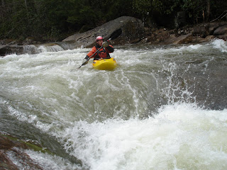
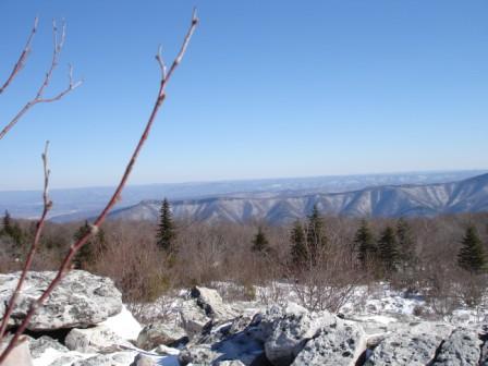
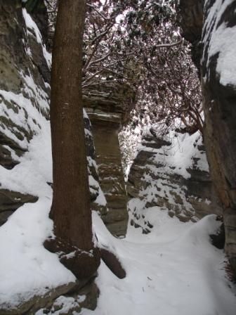
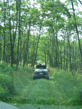
My name is Matt and I play in West Virginia. Actually, I'm addicted to the state.
Living inside or within a few hours of a WV state border for all of my life, I've had plenty of "West Virginia Moments," a characterization that could range from WV stereotype reinforcements of the cultural (could be bad) to the natural persuasion. Fortunately, the number of the latter is far greater than the number of former.
I wish to document with this blog these "West Virginia Moments." If you're reading this, then you are a friend or family member, or have stumbled upon this blog, and I thank you for reading and hope you'll get a laugh, discover a new natural place in WV, or gasp at the thought of it. However, the real reason for this blog is personal. I will consider this blog an archive of these moments for a man with a poor memory.
Enjoy!
16 September, 2008
A day of firsts
Despite my personal policy, it is worth noting that on Friday the 12th, Matt Z and I attempted a run of the upper reaches of Thompson Run in Penn Hills. It had rained all day and so we were happy to find the little micro-creek gushing with water. Devoid of any beta on this gutter of the Eastern suburb of Pittsburgh, we assumed incorrectly that the take-out was at Hank's Auto Body off Thompson Run Rd. The friendly (aka, drunk) patrons of the Universal Joint then directed us to a drainage ditch that was running and which we assumed was our put in for Upper Thompson Run. After a handful of portages, a lot of bushwhacking, and at least two chest-deep episodes in the disgusting sludge water, we "successfully" paddled about 500 yards of a drainage ditch that was no wider than our kayaks are long -- betcha can guess how we found that out -- before all of the water on which we were floating disappeared into a big pipe. Tails between our legs, we decided we need to do more research and have since deduced that Hank's is the put in, and that this could be a nice gem to ride all the way to Turtle Creek, or perhaps even further to the Mon after our next big downpour. A bit more daylight would be helpful, too.
But, that's too far north to be discussing at length in this archive.
So, on the following day and after disinfecting our gear, I was happy to lead three first-timers down the now familiar Lower Big Sandy (LBS). Those of us in the know for this run were not concerned about the skill levels of the three, especially given the beginner-friendly level at the bridge.
The three first known firsts of the day could be seen in the anticipation of our three newbies -- actually, just in Mike -- and the fourth was the level, 5.3 feet at the Rockville bridge, the lowest any of us had run it. Then, the ratio of beginners to experienced boaters (3:4) would be considered inadvisable and high and the highest any of us had experienced on the LBS. A 6th first was attempted and successfully carried out when we strapped a total of 8 boats to the roof of my car, a precipitous act considering that the drive to the put included Rockville Road.
A bit of mangled knuckle skin and some trauma discovered by two head-on piton at full speed later, the group arrived at the mouth of the Sandy as its sediment-laden waters dirtied the clear water of the Cheat.
Here are a few more photos from Saturday.
Git 'r Dun.
18 August, 2008
It's a mad, mad, mad, mad race
I was so sad on Saturday; so very, very sad.
You see, I had spent months running and pedaling my mountain bike up the gnarliest climbs I could find in my nearby woods and paddling up and down the rapids in the rivers all around my new home in Pittsburgh. It was all in anticipation of this year's Captain Thurmond's Challenge triathlon and it would be my third year competing. Everything looked to be perfect. My legs were fresh and strong and my fitness right where I thought it should be in order to perform well. I'd been in my new racing kayak for a few races and dozens of workouts, and at this point I really felt at home paddling it.
The race began well. The biking section would have a new course in 2008 so that the race could start and finish in Fayetteville, WV. After about a half mile of riding through the town's quiet streets, the racers entered the woods. We weren't quite spread out enough at that point, so some ritualistic bumping and passing was necessary. After a few descents and climbs on the singletrack course, I sat comfortably in position somewhere in the top 15 riders as the passing diminished. It was looking to be a good race!
Then, just as the race director had described in the pre-race meeting, the trail opened up to a graveled forest road. Down into the gorge I raced and once in awhile I was able to see a racer or two ahead of me when the road opened up for a straightaway in between switchbacks. Screaming down the mountain we went. At a rightward turning hairpin, a volunteer stood there, presumably for safety, encouraging us to keep going. A quarter mile further down the steep road in next hairpin turn to the left, the road opened again to a long, straight descent. I clicked my shifter into its highest gear and picked up speed.
I though it seemed odd that we were going so far away from Cunard.
Cunard is the place where we were to ditch our bikes for our boats and paddle to the end of the New River Gorge at Fayette Station. But, we were getting closer to Fayette Station on our bikes, not Cunard. Oh well, I thought, I haven't seen any course markers and there are still fresh tire tracks in the muddy sections. There must be riders ahead of me.
Slight panic began to sink in with my first glimpse of the New River Gorge Bridge, high above Fayette Station. This was a long way from Cunard. But there are still tire tracks! A group of hikers then encouraged me that there were eight riders ahead of me. Allright! I'm in 9th position! This is really my year!!
My slight panic became more intense when I reached the paved road and found one of my competitors, dejected, standing next to his bike.
"We're going the wrong way!", he shouted.
"Are you sure?", I protested.
"We're at the take out!", he said with eyes of disappointing solidarity.
A few bystanders disagreed. "The other racers went down that road!", they said. We shrugged to each other and off we went down the road. This road is one way, I thought, as we cranked our bikes as fast as we could down the steep, paved hill. But no cars approached us. Instead, we came upon those other racers that the bystanders had told us about.
"There's nobody down there!", one of them shouted, clearly infuriated. I was now in a group of about ten riders, two of whom won the race in previous years. This group was not happy. Kill the Monster lynch mob visions danced in my head.
Later, when I came upon a National Park Service Ranger's Jeep driving through the woods, saw the expression on his face, and heard the words he had to say, all hopes of seeing my results among the better ones in this year's vanished.
I had stopped racing. But, something inside me wouldn't allow it to be over until I heard it from an official. And, with the ranger's brown NPS uniform and white and green jeep, it doesn't get much more official than that in the New River Gorge National Recreation Area. I was just so sad.
And so, from Fayette Station, two riders decided to ride along the railroad to Cunard, disqualifying themselves from the race by doing so, but it was the most direct way to get to their boats so that their team could proceed. The rest of us began to backtrack. For miles (and miles!) we all had descended into the New River Gorge at breakneck speeds. Now we slowly ascended back out, feeling cheated. At the point where asphalt gave way to dirt, the two previous year's winners accepted a ride from a pickup, leaving about 6 of us to continue into the forest. We rode together, licking our wounds, bitching about how in the world a race director could possibly fail to mark a turn off a screaming fire road descent!
And that's when we ran into the ranger. His words should have reinforced what we already knew, but for some reason (denial) it was hard to hear that the entire race was now ahead of us because we'd missed a turn off that fire road.
Several hours later, after transcending the remaining grief steps (actually I was still stuck somewhere between depression and acceptance), I found myself back in Fayetteville. In the meantime, I had decided to stop racing after completing the remainder of the bike course and then paddling to a point where I found my friends from Three Rivers Paddling Club on the river. Telling race officials that "122 is pulling out of the race", as much as it pained me to say it, came at Fayette Station. I've felt this emotion before, but it's been due to injury, not personal protest and exhaustion. When I found the race director, things changed. I had clearly not been the only one ready to tell him exactly how badly he'd screwed up (er, how angry we were that he did). Shaking his head while holding it in his hands, he was courteously apologizing to each of the racers who stood in front of him. He knew that the mistake was on his watch whether or not he'd carefully instructed his volunteers. I imagined myself in his shoes.
And so I began to walk away after leaving him with my name for my refund check. As he maturely took his next tongue lashing from the line of tongue lashers, I looked up at the Fayette County Courthouse and the big, bright blue sky illuminating its stone facade and the dozens of townspeople who had come out to support the race. I stopped in my tracks and turned back. "Hey, Adam!", I shouted. The race director looked up like a victim. "I'll be back next year."
Git 'r Dun
Here's the Beckley, WV Register-Herald story on the race.
10 June, 2008
Whiting's Neck Cave
This one is a throwback and -- once again -- it was Jeremy's idea. I recently came across a photograph that reminded me of this one and decided it was worth writing up.
While I was living in the DC area, the Eastern Panhandle was about 70 miles from my home. In anticipation of a mild 2003 January weekend, the two of us spent far too many hours researching caves in the Harper's Ferry area on the Internet. I had heard of their existence, but as the code of grotto explorers the world over goes, their locations are not to be disclosed. I recently found my notes from the Internet sleuthing and resulting adventure.
It's called Whiting's Neck Cave, named after a nearby bend in the Potomac River, and somehow we found it. It required a day-long adventure because much of it was spent bushwhacking through fields and the woods. When we'd find a hole in the ground that looked like it might lead to a cavern, Jeremy would don his helmet and headlamp and get down and dirty attempting to squeeze himself in. If we'd have been spotted by a local landowner, I can only imagine the reaction upon one guy (me) standing guard with the other (Jeremy) only visible from the waist down, sometimes with legs spidering while he wrestled himself into an inverted vertical position.
After many hours of this despite being entirely convinced that we were walking on top of a cave, we finally stumbled upon a power line trail into the woods from a farmer's field that was mentioned in a vague online description of the directions to the cave. Along the trail, we found a few more holes that proved to only allow Jeremy to go subterranean to his ankles. Then, we finally stepped around a boulder garden that revealed a hole tall enough to walk into. About five feet in, the ground dropped into blackness and the top of a wooden ladder invited visitors to see what's down there.
It was just as we'd hoped. Crawling on the smooth, slimy, off-camber rocky cave floor, we dutifully became a muddy mess from head to toe as we shimmied through holes and squirmed around stalactites and stalagmites. A few interestingly large rooms enabled us to straighten our backs for a moment and get oriented before entering the next small tunnel. Jeremy broke out the Pep-o-Mint Life Savers, as expected.
Despite claims that the cave was linear (different exit and entrance), we each carefully kept a mental map for our way back out of the cave as we came to each bifurcation in the cave's passageways. Our Internet notes told us of a 50-foot rappel into a lower, terminal section of the cave and upon reaching a drop into utter blackness accompanied by a few rock bolts at the top for attaching a rope, we knew that we were there. And, we came prepared.
With a big heave after tying it off, the coiled rope was sent flying. We had tied a "stopper" knot into the lower end of the rope in case it wasn't long enough, but that didn't drive away the butterflies from swarming as I clipped in and started lowering myself over the precipice. There was nothing to see below me but painfully silent darkness. Slipping around on the slimy wall, I stumbled my way down the face and was soon standing safely at the bottom in a few inches of water. A short time after signaling up to Jeremy with a flicker of my headlamp, he was by my side at the foot of the big wall while the rope dangled for us to return.
After a bit more exploring in the lower section, we reached our turn around. Friends back home were instructed to notify help if they hadn't heard from us by a specific time, and in order to be sure to beat that time while allowing wiggle room for what may be a difficult climb back up what we'd rappelled down, it was time to go.
Retracing our steps back to the rappel was easy, and in a short time we were back at the foot of it staring at the dangling rope. This time, however, the darkness loomed over our heads as we looked up at a boot camp style 50-foot hand-over-hand climb up a slimy wall. With mud covered hands, we were a bit unnerved.
After a few attempts, we stood at the top and we were exceedingly glad to have worn helmets. And, climbing that rope was definitely not a solo job.
With the big hurdle behind us, we were light on our toes on the return trip. The task now was making effective use of our mental maps and at one junction we found that they were not the same. We reached a large cavern and were looking at two tunnels. While my instinct told me that the left tunnel was the way to go, Jeremy's indicated right. As the butterflies returned, sweat began to accompany an elevated heart rate. I'd freaked in a cave once before when I was in high school, and I began to feel the sensation again. Trying to stay cool, I suggested that we each take our own suggested route for exactly 5 minutes and returning. With luck, one of us would reach a point of recognition, confirming that route as the correct one.
When I freak, I tend to move quickly, perhaps to find comfort as soon as possible. I was happy to find that comfort in the form of a monster rock formation known as the Wedding Cake that we'd passed earlier in the day and of which we'd seen photos earlier in the week on a website. We met back at the freak out spot a few minutes later and Jeremy told me that his tunnel was a dead end.
With some of the remnants of anxiety staying with me, we quickly moved through the tunnels until we saw the light of day at the top of the ladder. When we got back to the car and into cell phone range, we made our phone call several hours before the dreaded, prearranged rescue time. Mission accomplished.
Unfortunately, I have no electronic photos from the day, but I do have the notes from the trip including detailed directions to the cave entrance. I don't consider myself a spelunker, but I respect the social mores of those who are. So, I'm not just giving them to any old Joe. You know how to contact me if you want them.
Git 'r dun.
14 April, 2008
The Thrill of Gravity
I didn't mean for it to happen, but somehow gravity played a significant role in the activities of the first warm weekend of 2008. And, I (somehow) got it off to a good start with a dinner that inspired Molly to articulate some ways in which West Virginia is "just like" Paris. Those particulars include riverside dining (in this case, the Monongahela River is like the Siene) and the well-placed, colorful flowers in common areas, but my interjections sealed the metaphor: the people are generally dirty and they eat rabbits; they smoke a lot and despite a lousy reputation among outsiders, pride in their homeland rules with intense fervor; not to mention, they talk funny and experiment with strange arrangements of facial hair.
After our special dinner in a centuries old grain warehouse overlooking the Monongahela, Molly and I headed for Nelson Rocks for an experience unlike any other. We met our friend, Kent, and his son, Zachary, for a vertical traverse of the via Ferrata -- a network of steel rungs, cables, and 100 foot long wood and cable bridge spanning 200 feet over a canyon -- to spots hundreds of feet above the forest.
The via starts difficult and crescendos to asinine by the time climbers get to the swinging bridge. We were graced with warm temperatures in the high 60's, but gale force winds made our experience gripping. Looking down at the small small planks of wood suspending your body on the cable bridge, all one has to do to look down at the forest below is to focus between the planks. "Don't look down" takes on a very different tone when it must be rephrased to "don't focus on the ground." Yeah right!
With each reach, stability is questioned as you climb the via Ferrata. What might normally be a perfectly stable position on a 12-inch wide step becomes precarious when the drop beneath the step would be a deadly fall. Yet, as more and more of the via was behind me, the cumulative experience left me more comfortable and trusting in the harness system anchoring me to the rock. However, when our guide pointed to the optional "bonus" loop that scaled a vertical and overhanging spire of rock that is 6 feet wide at the top with 500 foot drops on either side, comfort was diminished. Kent took the bait and started up. Molly was next, but only because I was right on her heels.
As the wall became an overhanging precipice, Molly spidered her way up. I did not. In fact, I am not even ashamed to say that it was never my intention to collect my "bonus." Rather, Molly continued under the presumption that I was right behind, got to the summit of the knife-edge of rock, belly crawled 10 feet across to the down-climb while the wind attempted to pluck her and Kent to the mercy of their harnesses, and slowly spidered her way back down to relatively safety. I got a couple jabs to the shoulder and she admitted that she was glad to have done it. It was a classic move, but I've been up on that "bonus" summit before and vividly remember saying I'd never do it again. That I could never do any real rock climbing is reinforced again and again.
The trip came to a solemn, pivotal crux when our guide, Brian, explained the dangers of releasing the safety harness from the via's security with his first-hand experience. It was less than two years ago when his then girlfriend fell to her death from the via. The story from the September 25, 2006 Pittsburgh Post-Gazette details Nelson Rocks' only fatality. Listening to Brian explain how the fall happened was ample reinforcement to never release both lanyards from the via Ferrata.
With visions of death, we ended our upward adventure by returning to solid ground where gravity isn't so lethal. We joined some of our paddling friends for dinner and then our group returned to the cabin at Dolly Sods to get our boating gear ready for Sunday's downward adventure.
Sunday morning, we woke to snow flurries. However, this group is braver than most. The thought of a day on whitewater in these conditions only inserted a small taste of hesitation among the group, but after a few layers of neoprene (er . . a few dozen layers), we were ready to go. We joined the Three Rivers Paddling Club Jim Blackham Memorial Trip by meeting them at the put in for one of West Virginia's most scenic runs, the North Fork of the South Branch of the Potomac's beautiful Hopeville Canyon. It was my first time in a Shredder -- a 2-man rubber catamaran raft -- and Molly's first time in the canyon. The gear worked and we both emerged at the bottom of the canyon dry, warm, and smiling.
Here are some more photos from Nelson Rocks, and here are some more from Hopeville Canyon.
Git r Dun
09 April, 2008
Webster '08
It's not just a bad sitcom featuring a really short guy being raised by an ex-NFL lineman.
Mother Nature played a mean trick on us before the 2008 Webster Springs Wildwater Festival by indicating to the professional forecasters that she'd be dumping more than 2 inches of rain from the WV skies in the 48 hours prior to the festival. Plans went from running rivers to creeks to drainage ditches. Message boards buzzed with proposals to make first descents of every ravine in the state.
But, it didn't ruin the weekend when less than a half inch landed in Webster County, WV.
I spent Thursday evening with Grease Fire, Doug and the Steves looking at online river gauges and guidebooks. Bandwidth spent, gear packed and courage steeped, we abandoned the Cheat River watershed and drove south on Friday to where her promise diverted. We were graced with minimal rain, though it was just enough to fill the banks of the Cranberry River in the Cranberry Wilderness of Webster and Pocahontas Counties. The pigeonhole effect brought several other groups to the only river with water that Friday, though the timing kept our group intact and isolated.
The dynamic was perfect and I reiterate my personal thrill in paddling a river as though it is the solution to a problem. Two boaters in our group had paddled the Cranberry once and both pleaded no recollection of the rapids. That put an intensity to the trip that provoked each boater's "A-game" to make an appearance. A-games abound, we shoved into the current. Scouting the unknown bends and half-blind drops in the Cranberry was done from our boats and not a single member of our group ran into trouble.
Friday night of the festival was mild as more and more vehicles rolled into Camp Caesar. Piled high on the vehicles, boats of every color brightened the dark, damp evening. Drinks were plentiful as the buzz escalated: What will run tomorrow? What are you paddling tomorrow?
Perhaps it was the success of our descent of the Cranberry or perhaps it was embedded in our desire to drive an extra few hours on soggy backroads, but John, Grease Fire, and I decided to head back north for Saturday's run to paddle the Tygart River from Arden, WV. That put us in bad position to come back to the festival, but as it turns out the rain never came on Saturday night and so our gamble paid off.
The minimum level for the Tygart River is 400 cubic feet per second. We found it at 1800, a high level, but (we'd decide after the fact) still safe. We drove along it first and declared the rapids to be Gauley-esque though a couple big hydraulics looked intimidating. None of us had run this river before and after paddling the Cranberry River the day before, the Tygart was a serious step up. Moat's Falls, a 15 or 20 foot waterfall, loomed downstream. Just above it were at least two ugly hydraulics.
It would be another success. This time we got out of our boats to take close looks at three sections, one of which was Moat's Falls, and decided to "sneak" a river-wide hydraulic next to an underwater rock cave by scraping down a nearly dry ledge of bedrock. Nonetheless, we all paddled over the lip of Moat's Falls and slammed into countless big waves and ugly hydraulics on our way down the Tygart.
Planning as we did, I even was able to make it to Pittsburgh with plenty of time to take Molly out for sushi, which was an interesting way of ending a day that began with greasy bacon, soupy eggs, and sausage gravy over biscuits being served by a local Webster County boy scout.
Check out more photos here.
Git 'r dun.
03 March, 2008
24 February, 2008
Dolly Sods Winter(less) Trip
I spent about 5 hours traveling back and forth from Pittsburgh to Friendsville, MD yesterday to solve a problem. I didn't realize that this was the reason, but in spending that time with my friend, Jason, articulating precisely how each of us feels about the activities that we share led us both to the same conclusion. We like to create and then solve problems.
And so, wearing this all-encompassing cloak, the activities that occupy both my professional and personal time fall into a comfortable category.
Last week I hosted a group of friends on a problem solving expedition to a cabin at Dolly Sods.In planning the trip, the problem to be solved had several constraints. The road to the cabin is impassible when covered in snow. The cabin has no electricity or plumbing and the cabin is heated by a woodburning stove. Food must be packed in. And, most importantly, it must be fun to endure all of these constraints. For months I badgered friends with tales of deep snow, high winds, and bitter temperatures. Email after email encouraged hearty participants to pack "layers, layers, layers" to stay warm and snowshoes or skis for efficient travel on the impassible forest road. I had loaded the cabin with three carloads of firewood in anticipation of the trip. Set aside weekends in February, I encouraged them; the snow will be there.
As it happens, the most limiting of that list would be voided by Mother Nature because there was no snow on the road and so we drove right up to the front door and unloaded our gear. In a trickle-down effect, other problems were subsequently voided and so we might as well drive in a few cases of beer, right?
With the initial problem solved, the group of 8 of us then began creating more problems to solve. The gas grill in the cabin ran out of propane and so we cooked on the woodburner. The trail we wanted to hike would end on a forest road, miles from both the car and cabin. We chose to hike it nonetheless, hoping the drivers could successfully hitch-hike back to the cars (they did). I don't doubt that the course of the weekend was dictated by the group's initial quest to come out of the trip feeling a sense of accomplishment.
I like to organize another annual trip that involves summiting a 3800 foot steep and rocky mountain in Shenandoah National Park at nighttime. Held in the late fall when there are no leaves on the trees to block the moon's full brightness, we solve problem after problem and then celebrate back at our rented cabin.
To get to the cabin at Dolly Sods, we drove up Forest Road 19 from the Eastern side of the plateau prepared to stop at the first steep section of road that was iced over. Encountering no such sections, we continued to the cabin and began a hot fire in the woodburner and began to discuss where we'd hike. The Red Creek trail won us over and the rest of the day was spent in the woods navigating our way on the approximately 7 mile hike along pristine Red Creek to the Rorbaugh Plains rock outcroppings. In doing so, we forded countless small brooks, some which were sheets of fragile ice, each one a small, independent problem to solve. We even spent about an hour solving the very difficult problem of crossing Red Creek, where the powerful water was ice cold and most exposed rocks were coated with a sheet of ice. Once that problem was solved by a few members of the group, we all decided that the existence of a solution was satisfying enough and we proceeded up the creek without crossing.
Back at the cabin, Saturday night became legendary as everybody disclosed the foods that they'd brought for the group. Because no coolers were needed, the group had packed in a feast. Grease Fire even showed up, driving his RC car all the way up to mountain and across the meadow. But, we had fireproof gloves with us and so nobody got burned. Even the dogs will never forget that evening at the cabin.
On Sunday we hiked the most popular trail in the region to the summit of Seneca Rocks and saw only two other people there. The benefits of winter adventuring reveal themselves over and over. Because there was no paparazzi, we were able to shoot an episode of the Michael Burke Show, which continued at the Purple Fiddle in Thomas.
Check out more photos here and here and here and here.
Git r' Dun.
31 January, 2008
Bloodline
At the request of somebody very dear to me, I am publicly admitting that after a year and a half, I now have WV running through my veins. In case anybody reading this is not convinced, here is some support of this admission:
While hiking recently, my friend Andrew commented that nobody his age (early-mid-20's) does anything like this (this being a very soggy hike down Big Sandy Creek after a big rain) and it got me thinking that either Andrew is somehow avoiding the people in WV who actually get out, or he is right.
Git 'r Dun.
- I drive the state's other official vehicle (not a pickup). It's a Subaru and it's very dirty. Always.
- My bookmark is a twig.
- The beard, which stores my bookmark while reading.
- Local parlance such as the following sometimes finds its way into my vocabulary: reckon (v.), holler (n.), yeller (adj.), and git 'r dun (v.).
- I just bought a dehydrator so that I can make my own jerky.
- I frequently describe things as being wild or wonderful.
- One of my current projects is a quilt.
While hiking recently, my friend Andrew commented that nobody his age (early-mid-20's) does anything like this (this being a very soggy hike down Big Sandy Creek after a big rain) and it got me thinking that either Andrew is somehow avoiding the people in WV who actually get out, or he is right.
Git 'r Dun.
02 January, 2008
Close Call on the Sandy
"GET ME A ROPE UP THERE!"
When it became clear that a swift and effective rescue was necessary, veteran Big Sandy Boater Max Harbert took the reigns of the rescue of his friend, Joe (name changed for protective measures), who had found himself in a potentially deadly bind at the notorious Splat rapid, a sequence of two difficult drops. The first drop cascades while losing about 8-feet of elevation as it crescendos through sticky and complicated holes and had reeled Joe into its G-spot. Squirting his boat into a short vertical dance, Joe landed upside down in the rapid's fast current headed for the second drop of Splat, a 15-foot waterfall that lands on a trailer-sized boulder. Separated by about 30 feet (seen in the photo to the right), the duo presents paddlers brave enough to attempt a run with little margin for error. Descending the waterfall safely requires a swift and strong trajectory to the left. Boaters swimming the bottom drop or running it in any other fashion are generally likely to be subjected to consequences ranging from serious injury to drowning.
Big Sandy Creek was running at an enjoyable level of 5.85 feet on the Rockville gauge for the final Saturday of 2007. When my kayaking partner for the day, Jason, and I got to the put in and began to suit up, I expressed surprise at the fact that there were no other cars parked there, giving us the false promise of a quiet and unobstructed run down my favorite local river. The fallacy of it was exposed within a few minutes when a caravan of six more vehicles arrived. Safety comes in numbers, so part of me was relieved and ultimately, the cliche proved itself true on this day.
The mile or so to the first waterfall, Wonderfalls, is an exciting warm up for the big rapids below and a good time for the paddlers in a group to become acquainted with each other. In this case, there were several first-time Sandy paddlers in two groups making up about 15 boaters. The first timers had all successfully run much more dangerous rivers like the Green (NC) and Blackwater, so we all proceeded with no concern and ran the approach and Wonderfalls. Waiting at the bottom of the 18-foot drop, the group saw no issues whatsoever and so we all peeled out into the current and moved on.
It was only a week ago at Wonderfalls where I had witnessed both the most fearful and astonishing moments of my whitewater experiences. After beaching himself onto the ledge at the top of a swollen Wonderfalls, a member of the group in which I was paddling spun sideways to a position parallel with the ledge, and toppled over, landing on his side. To our concern, he disappeared completely for an exceedingly uncomfortable period of time and we saw no equipment, boat or swimmer emerge from the violent hole at the bottom of the falls. After a minute or two, we astonishingly discovered that he'd executed a roll only to find himself behind the waterfall in the large space under the overhanging rocks.
A paddler swam at Little Splat. I was told that he hadn't met his annual quota, so there was little anything could do about it. There's no sense in fighting the River Gods.
The near tragedy then occurred at Splat, and the intensity of the rescue that ensued in the relatively small distance between Splat's two drops was bone-chilling. When the day's first Splat runner, Jason Hilton, indicated his intentions, I proceeded to the best rope-throwing position at the foot of the first drop. From this position, a rope can reach across the river far enough above the big waterfall to pull a swimmer to an eddy before an unthinkable swim onto Splat rock can occur. Jason, who runs Splat regularly, paddled through both drops without incident, perhaps giving Joe a poor impression of the precision required in running the rapid.
And so, equipped with the best wishes of all of the members of both group, Joe proceeded. His run was ugly from the beginning. With a near-flip at the top of the first drop, Joe was moving sideways while bracing hard on his right side as he entered the mayhem of the hole at the bottom of the cascade. Within a few seconds, he was attempting his roll while being pushed against the cliff on the right side of the river, where the current is at its strongest. But, his attempts failed as he scraped his paddle against the rocks over and over. Finally coming to rest underneath an overhanging section of the rocks, he quickly exited his capsized boat and found himself in a grotto behind a small waterfall. We were all relieved to see him give the "a-ok" sign by tapping his head with his hand. Joe even was hanging onto his paddle and boat!
Because I was on the left side of the river and Joe was inside a narrow space, I was unable to do more than to be ready to throw a rope to him if he came out into the current. I started walking back to where the group was all standing, but was quickly and smartly sent back to my position by Max. Several paddlers jumped into their boats, splashed into the water below the waterfall, and paddled across to the other side. Jumping to their feet with ropes in hand, they then quickly scaled the cliff and moved their way to a point directly above Joe.
The rescue from there went smoothly. Ropes and hands were offered to Joe, which he gratefully accepted and he, along with his boat and paddle, was raised to safety. Joe and Max hugged each other there on the rocks, and a small celebration erupted among the rest of us. I have been witness to such celebrations before, and it is difficult to adequately describe the feeling associated with seeing a life saved by the actions of others. It was a great way to end an unforgettable year of paddling.
More photos can be found here.
Git r' dun.
Subscribe to:
Posts (Atom)